Tuesday 26 September 2023

A cycling holiday in Brittany with Frank and Françoise (2nd to 11th September, 2023)

It was a year ago, in September 2022, that Frank and Françoise first mentioned that they were planning to organise a cycling trip to Brittany the following September.  In the year in-between, after an immense amount of planning and organisation by the two of them, the time had come!  There would be a group of 20 cyclists, including the organisers, of whom 6 would be travelling to France by campervan, 2 by car, and the rest by bicycle on the Brittany Ferry, departing from Portsmouth at 8.15 p.m. on Saturday, 2nd September.  At the last moment, a train strike on that day thwarted plans for those planning to travel to the Ferry Terminal by train.  However, everyone boarded the ferry.

~ Gill Finlay

Day 1 – St Malo (port) – Fréhel – Pléhérel-Plage (Camping l’Armor)

Gill writes:

Frank and Françoise were there in St Malo to meet us at the Ferry Terminal.

Panniers were loaded into their car and Frank led the cyclists out into the traffic of St Malo, keeping us safely on the right-hand side.  Françoise would be leading a convoy of Paula, Brenda, Tim and Pat in their campervans direct to the campsite, Camping l’Armor at Pléhérel-Plage.  It had been very misty on our arrival, but skies soon cleared to give a sunny day.  Once out of St Malo, there was a very steep descent to the Barrage de la Rance, followed by a correspondingly steep uphill!  We followed the coastline westwards through Dinard, St Briac-sur-Mer, and skirted two inlets, the second of which, Baie de l’Arguenon, we followed at sea level from Port à la Duc, before being hit with the nasty surprise of a VERY steep ‘killer’ hill!  But Françoise assured us later that the alternatives were much worse.  A coffee stop had been planned, but it seems many cafés don’t open on Sundays.  Instead, we had a stop in the centre of Matignon, where people were queuing for the bakery, which was open.  As we left the town centre, we were almost overrun by the crowds of people coming out of church.

Our next stop was in Fréhel at Frank and Françoise’s house, where Françoise and their good friends Roger and Jeannette Delobelle were waiting for us.  Roger and Jeannette had been helping with preparations for the delicious 4-course Welcome Lunch - Jeannette with some of the cooking.  Despite not speaking English, Roger slipped seamlessly into the role of 'Caviste' and had secured a more than adequate supply of Rosé d’Anjou, with much bonhomie.

Roger, Françoise, Frank and Jeanette
 
Let the feast begin

The afternoon disappeared!  At about 5 p.m. we were led on our bikes to the campsite.  The three campervans were already settled in a nice grassy area.  We quickly drew lots for the 2-bedroom chalets and settled in.  As it was such a lovely evening, a group walked to the nearby beach.

an evening stroll à la Plage de l'Anse du Croc

 
(31.8 miles/ 51 kms)


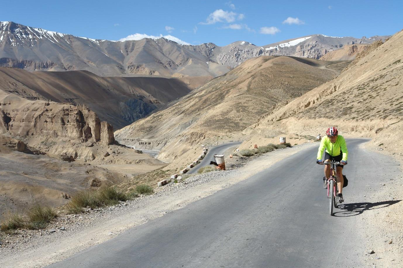
Day 2 – Cap Fréhel – Hénanbihen – Fréhel – Sables D’Or les Pins

Gill writes:

A small marquee had been set up for our use close to our chalets, furnished with two long picnic tables and a big fridge for storing food and drinks.  Each morning, we would meet here for a communal breakfast.  We set off on today’s ride (approx. 37 miles) in two groups, Frank's 'A Team' and Françoise's 'Alternative Team'.  Throughout the week, we tended to stay in these groups.

Looking towards the lighthouse on Cap Fréhel

 
Starting off on the coast, we cycled along it to the lighthouse on Cap Fréhel before turning inland to Plévenon and this time descended yesterday’s ‘killer’ hill – a much better option!  Continuing southwards, we cycled through farming country – sometimes open fields, sometimes between walls of maize.  There were some long drawn-out ascents, the last one ending at a welcome coffee stop in Hénanbihen.  It was hot work!  Iced coffees proved to be the drink of the day, with the bar owner doing an excellent job breaking up the ice in his cocktail shaker.
 
From here, it was a circular ride back towards Fréhel to a country restaurant, La Droséra, for a very good 3-course lunch, after which a few returned straight home. However, having been promised a flat ride, most of us continued in our groups to Sables d’Or les Pins for much appreciated ice-creams (the second group taking a short cut due to the heat!).  It was a very hot day!  A supermarket stop (La Coccinelle) in Fréhel, rounded off the day’s trip.  Soon we were home and heading straight into the shower – clothes and all!  That evening, we dined in the open marquee on supplies Françoise had laid in for a meal the previous evening, but which had not been required after our big lunch!


 (53 miles/ 85.3 kms)


Day 3 - Jugon les Lacs – la Fréheloise Microbrasserie

Tim writes:

Against all the odds Frank’s group of around seven riders departed the camp site at 9 am. As with many of the rides in the programme we made our way down to Fréhel, four kilometres away, stopping there on this occasion to use the cash machine by the Office de Tourisme.

Team Françoise waiting for Team Frank to depart

Though it never seemed to last quite long enough the first few kilometres on several of our days started off with riding through a still and rather atmospheric fog, sparing us the full onslaught of the solar rays for an hour or so. Today this was helped after 20 kilometres by a cooler ride through the Forêt de St Aubin which took us off our course but delivered us at over 25kms into the ride to Le Breizh Bar at Quintenic, a remote oasis in a small village but where we were welcomed with the refreshing coffee and cold drinks for which we were starting to yearn. Our first group didn’t have to wait long for Françoise to turn up with her somewhat larger peloton.

Our departure after Elevenses

Water buffalo

The ride continued via Plédéliac through undulating yet enjoyable countryside until it was time to descend to the town of Jugon-le-Lacs.

The town sits slightly lower than its lake, thanks to a small dam, so we climbed back up to ride along  the Eastern shore of the Étang de Jugon. We were able to spread out under the trees to eat the sandwiches we had made for ourselves before departure and admire the small catamarans for which there wasn’t a breath of wind.


We left our shady picnic spot and found a café among several in the centre of Jugon to prepare ourselves for the hilly ride home to which Frank had alluded earlier. In view of the heat, he had already decided to take a shorter route back, to avoid a big climb after Port à la Duc later in the day. Nonetheless the only way for the first 10 kms was up and was challenging.

We’d wondered where the other lakes were since we had only come across the one but it appears that the other one, to the North of Jugon has been created by building a dam on the Arguenon river (Barrage de la Ville Hatte) which, to the north-east of the barrage flows through Plancoët and into the sea after le Guildo.

We passed the Breizh Bar in Quintenic again but it was closed. After about 23 more hot and steamy kilometres we arrived at La Fréheloise which is a microbrasserie (brewery) on the edge of Fréhel. Several tasty beers were on offer, Blonde, Blanche (a wheat beer), IPA, and at least two others and we had a leisurely session quaffing away and celebrating Jen's birthday with a Breton Cake until it was time to head back to base-camp at Pléhérel-Plage.

Hallelujah! After struggling to park her bike Pam studies the beer menu

By some miracle there were still enough left-over left-overs from Françoise’s original food purchases for us to wine and dine communally in the marquee. A most jolly affaire.

(53 miles/ 85 kms) and just over 800m (2650 ft) of elevation gain.


Day 4 - Lamballe – Andel – Dahouët – Erquy

Gill writes:

This was another hot and humid day!  At breakfast-time we were told that plans had changed overnight as the restaurant in Andel which Françoise had booked for our lunch would not be able to cook lunch for us. Quelle horreur! Françoise was confrontred with the nightmarish spectre of 20 cyclists falling off their bikes with malnutrition. So it was necessary for us to provide ourselves with a sandwich lunch.  This meant starting the ride looking for a bakery which was open and able to supply both bread and fillings.  Success at last with the discovery of Origin'Bio, an organic wholefood supermarket, but the search had cut into our cycling schedule.  The plan had been to have coffee in Lamballe.  Instead, we ended up stopping earlier at a roadside café in St Aaron which was open and where the lady was only too happy to serve us.


We were lucky to come across this café in St Aaron

We now skirted Lamballe in order to arrive at the restaurant in Andel at the pre-arranged time.  The owner was no longer able to provide a meal but was happy for us to buy drinks and eat our own sandwiches.  Next to the restaurant there was a little park, an attractive stone church and another stone building being used as a library.

The afternoon’s ride led us back to the coast.  We had been forewarned of a steep descent, followed by a very steep climb, and today was the day.  The bottom of the near vertical climb saw most of us on our feet almost immediately!  Only 3 people made it to the top – John Beer and Liz, and Paula in Frank’s group!


Team Frank at our Tea stop in Dahouët

As we continued northwards, we started to get views to the sea and from now on followed the coast, coming down to sea level at Dahouët for a much appreciated drinks stop.  The inevitable climb out, then descent and steep climb at Erquy, gave us no rest on this hot day.  We bypassed most of the town of Erquy on back roads and were soon on our way home via Sables d’Or.  Tonight was Burger Night! Pre-ordered burgers of every flavour were delivered to the marquee, with Françoise’s special rice-pudding cake and custard, or ice-cream, for afters!

The rice-pudding cake baked by Françoise
(44 miles/ 70 kms)

Tim writes:

While Françoise’s group started the day by looking for a bakery Frank set out to take us for an early morning coffee in case there would be no other opportunity before lunch. But we had no luck at all and clocked up over 5 extra kilometres doing a most scenic but ultimately fruitless tour through Plurien and Sables-d’Or-les-Pins before catching up with the other group.

(48 miles/ 77 kms)


Day 5 – Rest day with a short ride to lunch near Erquy

Tim writes:

After four days of energetic riding we had earned our day off. The highlight of the day was a proper French lunch at the Relais-St-Aubin. While many of us chose to do very little before setting off at noon Terry and Tony cycled up to Cap Fréhel to explore the area around the lighthouse. Others visited the beach.


The ride to this most traditional restaurant was less than 12 kms so we were seated in the courtyard under canvas by one o’clock and our hosts Rauni et Gilbert Josset with staff were quickly in attendance and delivering our apéritifs. We had chosen our drinks and various courses from a bespoke menu well in advance so that our large group would be manageable for the hosts. So we were soon enjoying our various Fruits de Mer, fish, duckling, pork and beef dishes all cooked in the unique homemade styles of this establishment. What a feast it was, and finished off with a delicious assortment of desserts. Using locally sourced produce as much as possible the guiding principle for the hosts is “La qualité dans la simplicité”.


We rode back to camp slowly. Later several of us walked through the municipal campsite for a swim at our local beach. With not much of an appetite some gathered later at the bar in the Camping Municipal for a drink and a snack.

On the way back Carolyn spotted this curious statuette on top of a turret on a house near Sables d'Or.

(14 miles/ 22.7 kms)

Day 6 – Le Guildo – St Jacut-sur-Mer – Notre-Dame du Guildo – Plévenon

Gill writes:

Today was when we were joined by Gerald, a French friend from many previous trips, and Magalie, a lady cyclist heavily involved in encouraging more women to cycle.  They were with us for the weekend.  Gerald didn’t cycle but met us at all our stops. Magalie joined Frank’s A team.

Gerald and Magalie

It was another misty morning followed by another sunny day.  We set off at 9.15 a.m.  There were a couple of notable descents and climbs, followed by a long stretch on the Green Way, an old railway line, which was straight and level.  We descended to Le Guildo and stopped at the Restaurant du Vieux Chateau for our coffee.

A big climb took us up to the turn-off on to the St Jacut-de-la-Mer peninsula.  We cycled to the end, Pointe du Chevet, where we stopped to enjoy misty views out to sea, over several islands and numerous rocks visible due to it being low tide. We noted that the long distance coastal walking route GR34 runs right out to the point.

At Pointe du Chevet


From here it was back to Le Guildo via a very steep descent, and a climb up to ‘Resto le Guildony’ at Notre-Dame Le Guildo, where we had a very good 3-course lunch.  The return to camp was back to the Green Way, down to Port à la Duc and the ‘killer’ hill of the first day!  The second group stopped at Plévenon for a drink, even though it was a very short distance from here to the campsite.  Supper options, for those who felt in need, were pizzas at the Bar on the Municipal Camping Site.  There was a lovely sunset from the beach.

(34 miles)


Magalie, a sportswoman who has been riding both on and off road for over seven years, has been appointed by la Fédération Française de Cyclisme (FFC) as an Ambassadrice for the Ile de France region (one of three), a role with a mission to work with women to encourage participation in both road and mountain bike cycling by inviting them to join the activities which she organises for them. She is focussed on welcoming women at 'beginner' and 'intermediate' levels who are perhaps reticent about riding in a group or who wish to enjoy their cycling experiences with other women in a supportive and convivial atmosphere. She is a keen advocate of the health benefits of cycling and of participation in other sports. She is a member of her local club in Paris and an IT professional (in her spare time?).
 

It was wonderful that she could join us for our last two rides.

~ Tim


Day 7 – Bourseul - Pléven – Quintenic

Tim writes:

Our two groups set out on this last full day’s ride. As mentioned earlier, one of the pleasures of riding in the first half hour or more on several days was the cool misty haze over the landscape with the sun illuminating the atmosphere while hovering above, waiting to penetrate and disperse the fog. By mid-morning the heat was intense and we had to acclimatise to this each day.

We rode South towards Hénanbihen then further east to skirt Plancoët before reaching our Elevenses stop at the Café des Sports in Bourseul. Françoise’s group arrived there too, before we in Frank’s group had departed. But we learnt that her team had become spread out and suffered some communications difficulties due to a lack of reliable mobile phone signals. It also transpired that Sandy had punctured and John Beer had assisted with roadside repairs to get her up an running again.
 
We continued to follow the valley of l’Arguenon river until descending to cross a bridge,  the Pont de Pléven-Plorec, over Le Lac d’Arguenon  before a stiff half mile ascent to the village of Pléven. As planned, we found shade in the municipal park in Pléven to eat the picnic lunches we had prepared for ourselves earlier. The town of stone buildings had its charm as a ‘ville fleurie (2*)’, with the substantial church of St Pierre and what appeared to be a former bar still sporting a Guinness sign.


Soon after lunch we found ourselves heading through the shady forest towards Le Breizh Bar in Quintenic where we were welcomed for the second time. This time, as a bonus, there was a big bowl of chilled ripe plums on the table to complement our liquid refreshments.

We made our way back via La Bouillie and Plurien to shower and scrub up for our Farewell Dinner at the Kasino Restaurant in Sables d’Or-les-Pins. A local taxi firm shuttled us to the venue and we relaxed outside to enjoy our view of the sea with apéritifs and canapés before sitting down around the big table indoors for our sumptuous 3 course dinner.


Much later in the evening our taxis came to take us back to camp.

(39 miles/ 63kms)

Day 8 – Pléhérel-Plage – St Briac-sur-Mer – St Malo (Ibis Hotel)

Gill writes:

This was our last day – the return to St Malo.  Our panniers were taken by taxi to the Ibis Hotel in St Malo, where we would be spending the night.  Chalets had to be cleaned and   inspected before we could leave.  It had rained overnight.  Skies were still stormy-looking and it was very humid.  During the morning there were bursts of sunshine which made it feel even warmer.  Gerald and Magalie waved us off as we left at 10 a.m., all in one group now with Françoise leading and Frank as back-marker.

The route was along roads which were now familiar, Fréhel, Matignon, Le Guildo, Ploubalay.  We reached St Briac-sur-Mer by 12 noon.  The square was full of people at tables outside a bakery and three cafés.  One café was due to close at 1p.m. and the popular one was running low on savoury food items suitable for lunch.  Skies had clouded over by now and soon it rained quite heavily.  We waited till it had eased before setting off on the last lap through Dinard, across the Barrage, up the last steep hill and into St Malo.  We checked into the Ibis Hotel which was situated on the waterfront overlooking a vast sandy beach.  It was a glorious sunny day again and it was not long before a group of us set off to explore, walking to the Castle and through the gate into the walled Old Town.  There were throngs of people everywhere!  We eventually found a café where we had much-needed cold drinks.  Later, some of us had a very good meal at the Italian restaurant next door to the Hotel.

Meanwhile the campervan folk (Paula, Brenda, Pat and Tim) had driven up to Cap Fréhel for a walk around the lighthouse and out to the point. Then directly to the campsite at the Cité d’Aleth which is within walking distance of St Malo.

 (30.5 miles/ 49 kms)

Next morning, after an early breakfast in the Hotel, we loaded panniers on to the bikes and at 8.45 a.m. Frank and Françoise led us to the Ferry Terminal, where we said our final farewells.  It had been a wonderful holiday!  Thank you so much!

(1.5 miles/ 2kms)  

~ Gill and Tim, September 2023


Postscript from Frank and Françoise

A cycling tour success is not only due to its leaders but also to its participants.

Warm thanks have to be given to you, The Group, who have been perfect members, a pleasure to lead, a pleasure to have your company for a week, always punctual every day. Your smiles as you were checking-in at Saint-Malo erased the preparation hiccups and replaced those with the satisfaction we now feel having shared with you a part of the world where we spend many happy summers, albeit never in those steamy conditions! 

THANK YOU. MERCI. 

See you around!


P.S. Although a few ad-hoc changes were made to the planned routes on some days this is the routes book with each day's rides:

https://ridewithgps.com/collections/2116501?privacy_code=Q1mTv9GZ9J4tV5Yyc2TI6IUMUNM70HvU


Saturday 9 September 2023

More Cycling in the Himalayas

I have a fascination with mountains and particularly big ones. As previously recorded Paul and I did a memorable tour of Tibet and Nepal in 2006. The Himalayas have featured in my cycling holiday destinations on 3 further occasions.

Ladakh in August 2009 – with my older son Andy. Unfortunately, Paul could not get time off work.
Sikkim in October 2010 – with Paul and John Beer
Bhutan in October 2013 – with Paul

All the trips were CTC holidays led by Pat and John Ashwell. Pat and John have the right level of hands-off group management to encompass the needs of fast and slower riders, and their tours are very well organised.

The tiny, isolated Himalayan kingdoms of Ladakh, Sikkim, and Bhutan are squeezed between the powerful countries of China and India. For centuries their monarchs enjoyed absolute power in their mountain strongholds, venerated by their subjects as embodiments of gods, but in the 20th century the supremacy of these domains fell. In 1947, partition left Ladakh a part of India, Sikkim became India’s twenty-second state in 1975, and in 2005 Bhutan became a constitutional monarchy.

LADAKH TOUR


Ladakh, one of the highest regions in the world, frequently called Little Tibet, offers remote high-altitude beauty and dramatic scenery with elaborately decorated Buddhist sanctuaries, stupas, and former royal palaces set in the nearby rugged valleys amidst magnificent towering crags.

Ladakh was a very important trade route in Asia and collected taxes on goods that crossed their kingdom. However, this trade dried up when China closed the borders with Tibet and central Asia. The Indian government has encouraged tourism in Ladakh rather than in the troubled Kashmir region where territorial conflict, primarily between India and Pakistan, is still active.

The tour takes the classic Manali to Leh route passing through two 5000 m and two 4900 m high passes with spectacular scenery. The safe cycling window in the mountains is limited as the weather can be extreme. The 474 km long highway begins from Manali and is normally open from June 01 and officially closes on September 15 every year; in practice it remains motorable till the end of October (‘official’ means that the Indian government won’t airlift you if you get trapped in snow). Foreigners must obtain an Inner Line Permit (ILP) to visit Ladakh as well as an Indian Visa.

We went mid-August at the end of the monsoon period and the beginning of the winter season. Groups have been caught in extreme weather, so our back-up transport was adequate to transport us all in such a case.


The group flew to Delhi, stayed overnight and then flew to Manali which is at 2000 metres, so we stayed a day to acclimatise, and rode locally to visit our first temple at Nagar. Manali is situated in a green valley at the base of the Himalayas, so the climbing began as we headed into the mountains to camp at 3320 m. We had rain as we were still in the shadow of the monsoon and the route was still green with pine and deodar trees.
The next day took us out of the green monsoon zone, and we entered a barren landscape devoid of any significant vegetation. Ladakh is shadowed by the mighty Himalayas and the rain clouds of Indian monsoon reach the mountain barrier and stop, and never get to enter Ladakh to give rain. The moonscape scenery is spectacular.

Our route took us over the following passes:
Rhotang La pass – 3950 m,
Baralacha La pass – 4850 m,
Narmkeela La pass – 4950 m,
Lachlang pass – 5090,
Taglang La pass – 5332 m (similar elevation to Base Camp Everest)

The roads were sometimes surfaced at lower levels but at the higher elevations were dirt and gravel. Minor landslips were common, but we were lucky as we did not have to make any detours. Traffic was quite light, and you could always hear and see an approaching dust cloud. The main threat was Indian Army Convoys who patrolled the route and did not give way for anything.

The roads are under constant repair by the BRO. The Border Roads Organisation (BRO) is a road construction executive force in India that provides support to and is now a part of the Indian Armed Forces. BRO develops and maintains road networks in India's border areas and friendly neighbouring countries. BRO place warning signs at difficult areas and the puns are quite amusing.

I am curvaceous be slow

Overspeed is a knife that cuts a life

Let your insurance policy mature before you

The BRO workers sometimes camp by the roadside in very minimum facilities and our support crew would sometimes stop and give them some snacks and water.

We had 7 nights under canvas, and I don’t think there was any alternative accommodation as the route has few developed areas. The tents, mattresses and sleeping bags were four seasons quality so we were not cold at night. The support group were great, and each day went ahead and pitched the site before we arrived. They had tea and biscuits ready when we arrived and hot water for washing. In the morning they struck camp after we had left, and an advance party drove ahead to organise roadside snacks and lunch. Lunch was either a roadside picnic or sometimes in a bar.

The campsites were usually in a valley, so we had spectacular views of sunsets and sunrises over the mountains. Once the sun set the temperature plummeted, but we had a large mess tent and a gas heater for communal meals. The group was an interesting mix of people, as with all CTC tours I have been on, so meal-time conversation was good fun.

The food was good consisting of what could be sourced locally – rice, dal, flapjacks, eggs, porridge and tea. The support group always made sure that we had a supply of Tiger beer.

The campsites were chosen as far as possible to be lower than the highest elevation reached during the day as this reduces the impact of altitude sickness. I personally found the sleeping difficult as I kept waking up because of my breathing and I developed a cold, so I welcomed the descent to Rumpste and 3 nights in a hotel in Leh at only 3400 m. I did not have any significant problems on the Nepal and Tibet trip which backs up comments that altitude problems are not predictable and not related to fitness.

Our final challenge was Khardung La pass at 5359 m, which has been frequently referred to as the highest motorable pass at 5,359 m (17,582 ft). However there have been reports which claim that a well-graded Indian military road at 5,610 metres (Mana Pass on the India-Tibet border) is higher.

The climb from Leh to the top of the Khardung La pass is 41 kms long and has an elevation gain of 2200 m. The last 10 kms are unsurfaced and the bends seemed to be very steep, but at this height power output is very low. Because of the reduced barometric pressure, the effective oxygen concentration is approximately 50% of that at sea level – 20.9 % at sea level compared to 10.7 % at 5350 m.

The view from the top of the Khardung La is spectacular stretching from the Indus valley in the South over the endless peaks and ridges of the Saser Massif in the North.The climb took about 4 hours, but it did not take long to return to Leh. All the ladies in our group completed the climb but several men opted out.

Leh is a bustling town and frequented by young travellers so quite different from the high mountains. There are narrow streets to explore and plenty of small shops, eating places, and Leh palace and Sakar Gompa monastery to visit.

We returned via Delhi and booked a tour of Delhi with a difference – Cycle Old Delhi. We were issued with old style bikes, and we visited many narrow streets and markets and saw Delhi as few people have seen. Safe working practices do not exist – we saw men using pickaxes and jack hammers wearing flip flops. The organiser was trying to establish the Cycle Old Delhi tour and I hope he was successful as it was great fun.

We had a day to explore so Andy and I used the metro. It was very crowded, and we were both relieved of our small pocket cameras. In my case I had my camera in a zipped pouch in front of me but that was ineffective as I felt somebody thump me in the stomach and my camera was gone. The morale is to avoid crowds. The hotel arranged a rapid response – for us to visit the local police station by rickshaw. The police would not issue a stolen items report as we could not prove that we had been pickpocketed, but after a lengthy discussion they agreed to issue a lost report which was good enough for the insurance claim. I think the incident which would make a good basis for a comedy clip. Unfortunately, our photos were on the memory cards which was the real loss – we were kindly given photos by group members.

There is much written about the caravans that crossed the silk road – Leh was a major crossroads. The Silk Road that began in the second century, thrived for 1,600 years until the Ottoman Empire closed trade with China in the 14th Century.

It was an arduous passage as the Ladakhi traders had to cross over the Khardung La at 5,359 metres. They journeyed from the head of the Nubra valley through the Sasser La at 5,411 metres across the Depsang Plains at 5,376 metres to reach the cold desert of Daulat Beg Oldie (DBO) at the easternmost point of the Karakoram range and finally over the Karakoram Pass at 5,540 metres before they could reach Yarkhand.

Despite the harsh climate and the inhospitable terrain of the Himalayas, apart from the fear of being looted by bandits and dacoits, every year, hundreds of caravans embarked on this long journey that took several months. This Pass is still strewn with bones and skeletons of pack animals that died due to lack of vegetation. It is popularly known as the Skeleton Trail.

Other references record that if you could not keep up you were abandoned by the roadside to freeze. CTC tours would not allow this practise, so we had the alternative of the minibus.

In summary the Ladakh trip was an experience but a challenge. Don’t try it if you moan about the North Downs.


SIKKIM


Sikkim is a state in North-eastern India. It borders the Tibet Autonomous Region of China in the north and northeast and Bhutan in the east. Sikkim’s breath-taking landscape includes permanently snow- covered mountains and steep-sided valleys filled with verdant subtropical forests and stands of rhododendron. Scattered throughout are traditional Tibetan Buddhist monasteries filled with stunning murals and Hindu shrines of the Nepali people.

We travelled to Bagdogra in West Bengal via Delhi. Foreigners must obtain an Inner Line Permit (ILP) to visit Sikkim as well as an Indian Visa. The route was circular entering Sikkim from Darjeeling and travelling to Mangan as the furthest point North.

Our route did not enter the high mountains and the highest elevation reached was 2100 metres. The roads were surfaced but with rough and broken stretches and many of the hills were very steep; some of the descents were challenging. We were given the option of vehicle transport on one long wet downhill section with poor road surfaces – I found it was OK with good V brakes and nerves – just!


We were also recommended to take the vehicle on one climb which the support team said was just too steep to ride and at least 10 kms long. I thought the description of the elevation gain defied the geography, so I rode. It was like riding half a dozen consecutive Whitedown Hills but the reward at the top was more spectacular views and a lovely ride along a ridge.

Sikkim is very beautiful and most days we rode in the foothills and had views of the snow-capped mountains. Tea plantations rolled across the countryside with purple Jacaranda trees making a vivid contrast.

The villages are picturesque with livestock wandering around. It is difficult to see what employment there is apart from rudimentary farming. The Indian government is trying to give people a job, but the only evidence of this was ladies dressed in their colourful saris breaking rocks using hand tools, sitting at the roadside under large umbrellas as protection from the sun.

Some of the hotels were old colonial buildings and you could experience the colonial lifestyle – lovely gardens – stunning views – 4 poster beds – thick carpets – heavy wooden furniture and cushions – lots of tea and biscuits – elegant dining rooms – ceiling fans slowly rotating – typical Indian food and wonderful service. Don’t forget the Tiger beer.

In contrast we stayed one night in the Mount Norsing Village Resort which is a collection of huts with unforgettable 360-degree views of the white mountain peaks. We were transported to the resort by jeeps as the approach track was unrideable.

In Darjeeling we visited the Sherpa Tenzing museum which has a good collection of old and new equipment used by Tenzing Sherpa and others. It really shows how primitive the early equipment was. The museum also displays the history of mountaineering around the Himalayas.

We did not find a chance to travel on the Darjeeling Himalayan Railway, also known as the DHR or the Toy Train. It is a 610 mm (2 ft) gauge railway that runs between New Jalpaiguri and Darjeeling. Must be worth a train trip for any enthusiasts.

We visited several temples and each one was impressive both in architecture and the dedication of the priests. Rather than risk temple fatigue I won’t go into detail.


BHUTAN


In Bhutan, emerald rice paddies cascade down the hillsides, remote centuries-old monasteries cling to the cliffs, and massive Buddhist sanctuary-fortresses dominate picturesque towns where houses are decorated with magical charms to keep the evil spirits away.

Bhutan imposes a minimum visa fee per night so a trip to Bhutan is quite expensive, but the scenery is spectacular, and Bhutan must still get enough tourists to justify the pricing policy.

We travelled via Delhi to Paro. The flight from Delhi to Paro is subject to good weather and we just made it before heavy rain and high winds closed the airport. We arrived in Delhi during a festival which was probably Divali, wandering in the back streets was good fun as people were dressed in their finery, candles were burning in shops and houses and groups were parading large papier-mache statues. In one area they had constructed a temporary shrine and people were filing past an amazing display of candles and decorations. In the evening there was a musical event.

Our cycling route took us east from Paro to Sarndrup JongKhar – see map below. Road surfaces were generally good and gradients manageable. Accommodation was 11 nights in comfortable hotels or guest houses, and 4 nights camping in the more remote regions. One of the campsites was in the grounds of a temple – a lovely location with a bonus early morning call of chanting. The highest elevation of the trip 3225 m was the campsite at Ura. I vividly recall the warmth from a big bonfire and the incredible star scape.

There was a lot of climbing but as we were mainly below 3000 m altitude effects were limited.

Our first day was a trek to Paro Taktsang, also known as the Tiger’s nest. This is a sacred Vajrayana Himalayan Buddhist site located in the cliffside of the upper Paro valley in Bhutan. It is said to be oneof thirteen Tiger's Nest caves in historical Tibet in which Padmasambhava practiced and taught Vajrayana. It is believed that Padmasambhava flew to this location from Singye Dzong on the back of a tigress. This place was consecrated to tame the Tiger demon.

The Tiger’s Nest is built into the rock face and the logistics of the construction must have been an incredible challenge as access is very limited. We visited several temples on the tour and each one was impressive, but the Tiger’s Nest is high on my list of must visit sites.

From Sarndrup JongKhar we had a 3-hour road transfer to Guwahati airport. Security was tight and we were stopped at several check points. A few of us needed to stop for the call of nature which is the only time I’ve had a pee whilst being protected by a guard with a gun.

The scenery in Bhutan is spectacular, food was good, the company was fun, so cycling was a pleasure.

Here is the link to the Bhutan video. https://www.youtube.com/watch?v=JSV6CbM8luI


Summary


If I had to choose from my Himalaya trips, I would struggle to select a preference.

The Nepal and Tibet trip was probably the most spectacular and enjoyable because of Everest combined with overnights in several interesting towns, but the remoteness of the Ladakh landscape is also special. Both trips were physically tough. Perhaps the opening-up of Tibet, with road improvements and access by rail now increasing tourism, would make me think twice of re-visiting Everest.

Sikkim and Bhutan were very pretty and easier riding, but from the perspective of a bike saddle viewpoint I think Sikkim edges out Bhutan. Perhaps the paddy fields and limestone karsts of Vietnam are a comparable cycling experience but that’s another tour.

~ Ken & Paul Day
This report was first published in The Sou'Wester, May-June 2023 edition.